
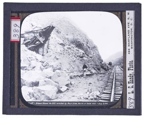
Steam Shovel No. 225 wrecked by Rock Slide
North of Gold Hill, July 5, 1911.
Handy (Photographer), Hallen (Photographer), Special Collections/University Archives (Publisher)
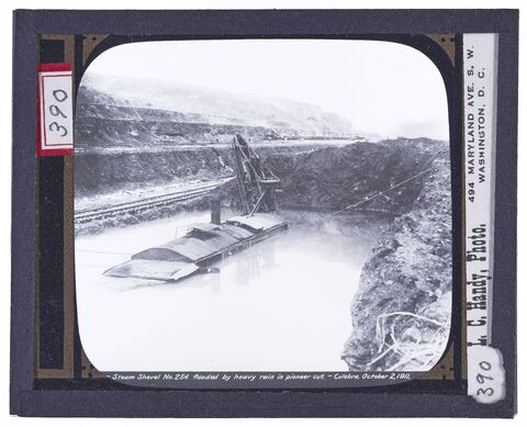
Steam Shovel No. 254 Flooded by Heavy Rain in Pioneer Cut, Culebra, October 2, 1911
Handy (Photographer), Hallen (Photographer), Special Collections/University Archives (Publisher)
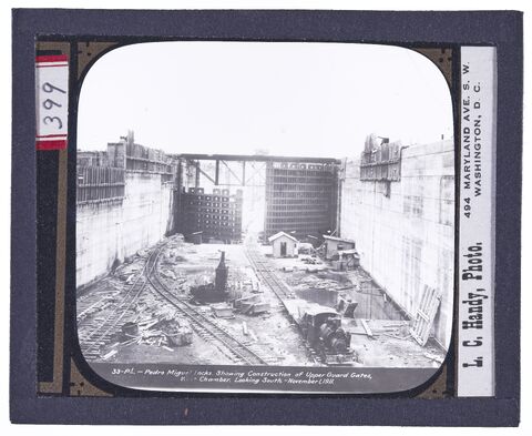
Pedro Miguel Locks
Showing Construction of Upper Guard Gates, West Chamber, Looking South, November 1, 1911.
Handy (Photographer), Hallen (Photographer), Special Collections/University Archives (Publisher)
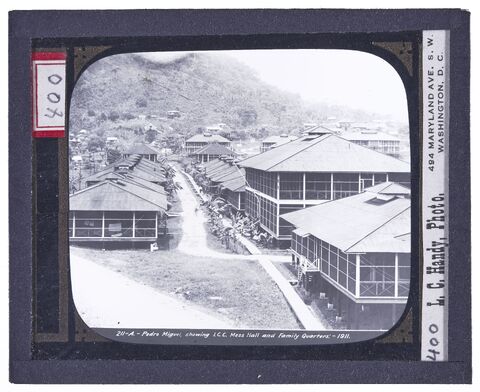
Pedro Miguel, Showing I.C.C. Mess Hall and Family Quarters, 1911
Handy (Photographer), Hallen (Photographer), Special Collections/University Archives (Publisher)
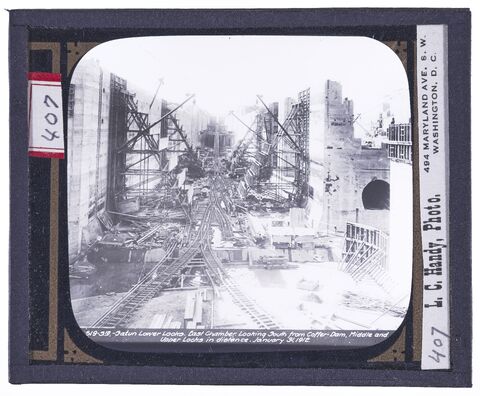
Gatun Lower Locks. East Chamber
Looking South from Coffer Dam, Middle and Upper Locks in Distance. January 31, 1912.
Handy (Photographer), Hallen (Photographer), Special Collections/University Archives (Publisher)
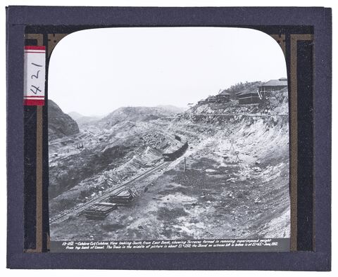
Culebra Cut, Culebra. View looking South, from East Bank, Showing Terraces formed in removing superimposed weight from top bank of Canal
The train in the middle of picture is about El+250. The shovel on extreme left in bottom is at El+65. June, 1912.
Handy (Photographer), Hallen (Photographer), Special Collections/University Archives (Publisher)
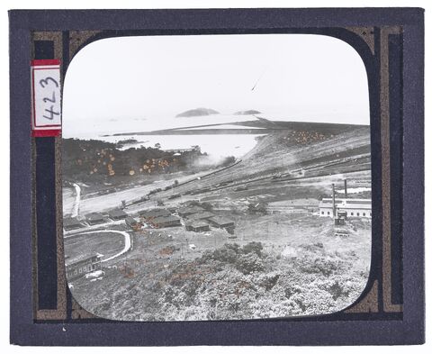
Unnamed picture of a small town on a hillside overlooking the ocean, apparently near one end of canal
Handy (Photographer), Hallen (Photographer), Special Collections/University Archives (Publisher)
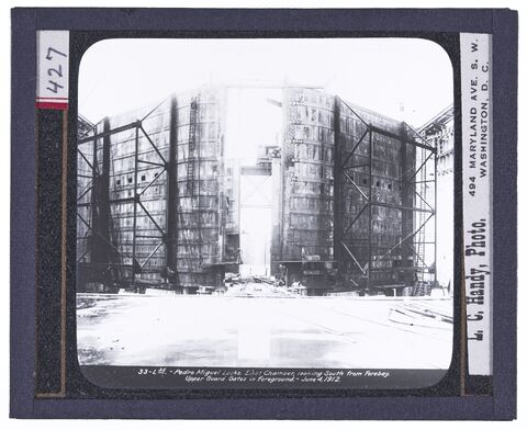
Pedro Miguel Locks. East Chamber
Looking South from forebay. Upper Guard Gates in Foreground. June 4, 1912.
Handy (Photographer), Hallen (Photographer), Special Collections/University Archives (Publisher)
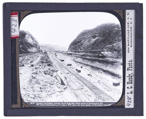
Culebra Cut, Culebra
Looking North, from West Bank, South of Contractor's Hill. The lowest steamshovel cut is about 16 ft. above the final bottom of the canal. June,
Handy (Photographer), Hallen (Photographer), Special Collections/University Archives (Publisher)
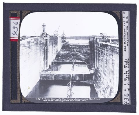
Gatun Upper Locks
View looking south, showing west forebay and south center approach wall. June 1, 1912.
Handy (Photographer), Hallen (Photographer), Special Collections/University Archives (Publisher)
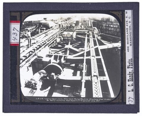
Gatun Upper Locks. Miter gate moving machine
Structural steel girders for towing locomotive track supports in foreground. June, 1912.
Handy (Photographer), Hallen (Photographer), Special Collections/University Archives (Publisher)
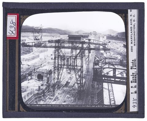
Miraflores lower locks, General view from Berm Crane on east bank
Looking north. August 10, 1912.
Handy (Photographer), Hallen (Photographer), Special Collections/University Archives (Publisher)
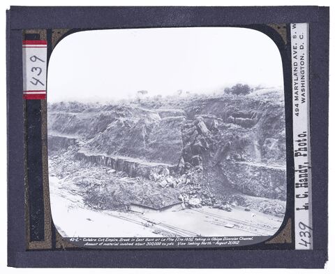
Culebra Cut, Empire. Break in East Bank at La Pita, taking in Pbispo Diversion Channel
Amount of material involved about 300,000 cu. yds. View looking north. August 21, 1912.
Handy (Photographer), Hallen (Photographer), Special Collections/University Archives (Publisher)
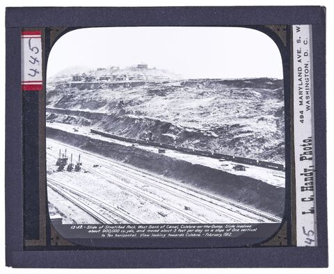
Slide of Stratified Rock, West Bank of Canal, Culebra-on-the-Dump
Slide involved about 900,000 cu. yds., and moved about 3 feet per day on a slope of one vertical to ten horizontal. View looking towards Culebra.
Handy (Photographer), Hallen (Photographer), Special Collections/University Archives (Publisher)
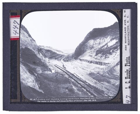
Culebra Cut, Culebra
Looking north from West bank near Contractors Hill. The water in center cut shows bottom of canal. Dec. 28, 1912.
Handy (Photographer), Hallen (Photographer), Special Collections/University Archives (Publisher)
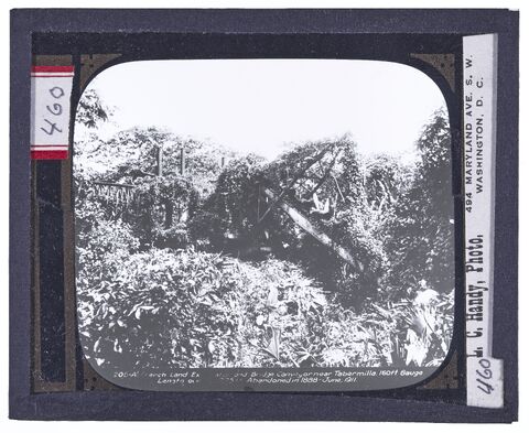
A French Land excavation and Bridge Conveyor near Tabermilla 160ft
Gauge length over 225 abandoned in 1888. June 1911.
Handy (Photographer), Hallen (Photographer), Special Collections/University Archives (Publisher)
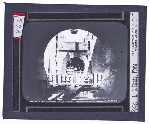
Gatun Upper Locks
Looking out from a Center Wall culvert laying concrete. Oct. 15, 1911.
Handy (Photographer), Hallen (Photographer), Special Collections/University Archives (Publisher)
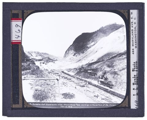
Culebra Cut. Cucaracha Slide
Steam shovel No. 256 working on the bottom of the canal. Jan. 4, 1913.
Handy (Photographer), Hallen (Photographer), Special Collections/University Archives (Publisher)
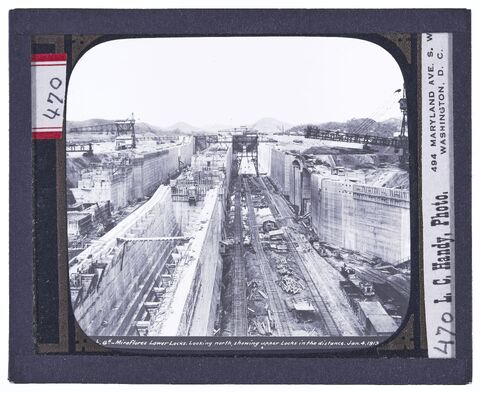
Miraflores Lower Locks
Looking north, showing upper locks in the distance. Jan. 4, 1913.
Handy (Photographer), Hallen (Photographer), Special Collections/University Archives (Publisher)
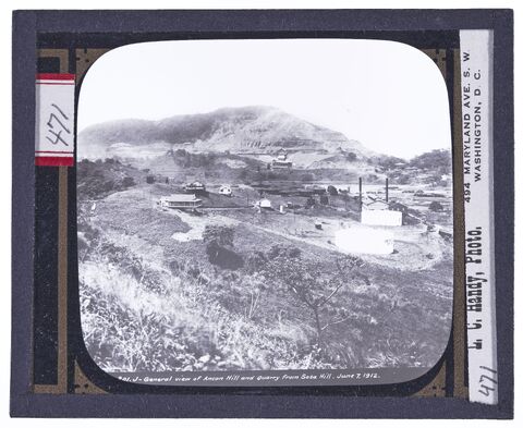
General View of Ancon Hill and Quarry from Sosa Hill. June 7, 1912
Handy (Photographer), Hallen (Photographer), Special Collections/University Archives (Publisher)
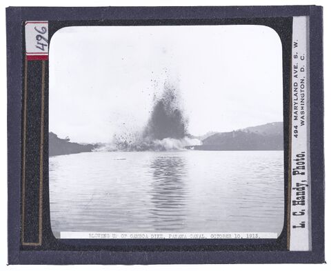
Blowing up of Gamboa dike, Panama Canal, October 10, 1913
Handy (Photographer), Hallen (Photographer), Special Collections/University Archives (Publisher)
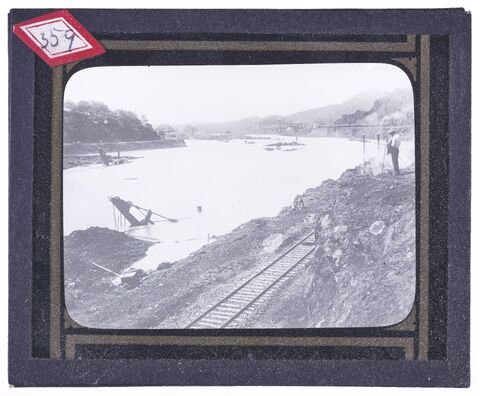
The Cut at Bas Obispo during the Flood of Nov.19, 1909
Handy (Photographer), Hallen (Photographer), Special Collections/University Archives (Publisher)
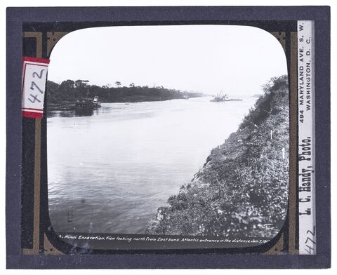
Mindi Excavation
View looking North from East Bank, Atlantic entrance in the distance. Jan. 7, 1912
Handy (Photographer), Hallen (Photographer), Special Collections/University Archives (Publisher)
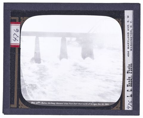
Gatun Spillway
General view from East Wall North of Bridge, Nov.27, 1912
Handy (Photographer), Hallen (Photographer), Special Collections/University Archives (Publisher)
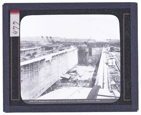
Gatun Lower Locks
Looking North from the middle locks. Jan 7, 1913
Handy (Photographer), Hallen (Photographer), Special Collections/University Archives (Publisher)