The Merrill W. Linn Conservancy Digital Dashboard is a website that pulls together a set of four digital tools designed as a resource for Linn Conservancy staff and site stewards for the following purposes:
Property Profiles & Map Tour. Use this tool to review & browse through key information, materials and documents related to existing Linn Conservancy easements and properties. This information is provided as both an overview of all existing Linn Conservancy easements and properties as well as a landing pages for each individual easement/property that provides details, including a tour of the property’s photo locations. [This is an embedded ArcGIS Storymap]
Parcel Prioritization App: Use this tool to identify parcels of land in Snyder and Union County that are available for conservation. We have defined this as parcels of land that are not currently classified as conserved lands - including conservation easements, farm easements, federal, state, local and privately conserved land parcels). The app includes filters that can be used to identify parcels that meet specific requirements such as proximity to existing conserved lands, acreage of wetlands, species richness and other qualitative and quantitative variables relating to Linn Conservancy’s conservation values. This will be expanded to include data for Northumberland and Lycoming pending availability of parcel data. [This is an embedded ArcGIS Dashboard]
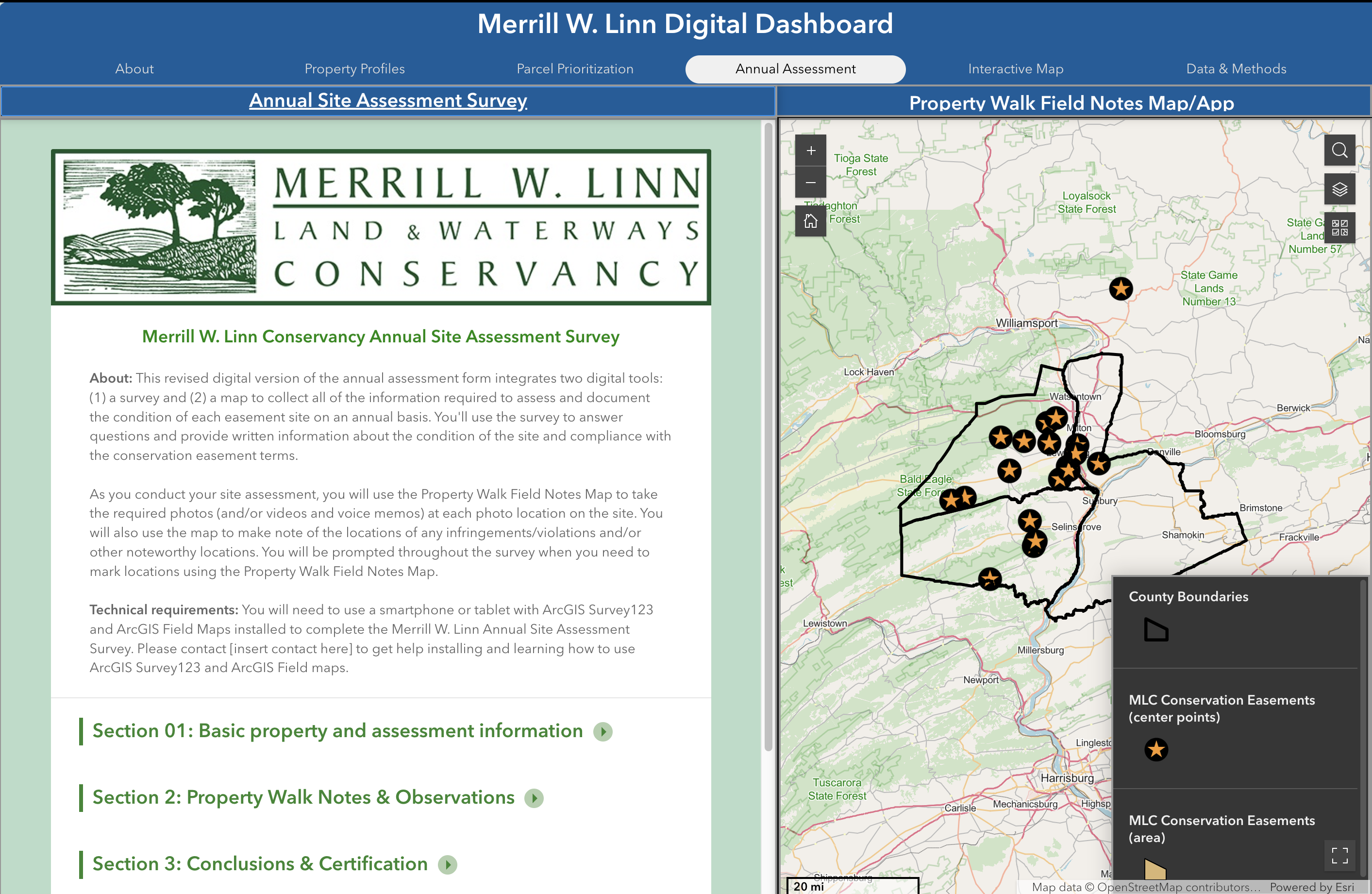
Annual Assessment Survey & Property Walk Notes Map/App. Use this to complete annual site assessments, including capturing photo location images and notes on infringements or other observations made during the property walk. The annual assessment survey and its accompanying property walk field notes map/app capture the key information from the paper form used in previous years and add a few additional pieces of information. Most importantly, the assessment data is captured in a digital format, making it easier for staff and stewards to access and compare information across time and properties. Photo location images capture in each year’s assessment will be viewable in the Property Profiles & Map Tour page at the end of each assessment cycle.
Conservation Values Map Explorer. Use this interactive map to explore current Linn Conservancy properties and parcels available for prioritization along with a variety of map layers related to conservation values such as species richness & habitat, wetlands, landcover, etc. (see Data for more details). In summer 2024, Prof. Elizabeth Capaldi (Biology) worked with Janine Glathar (GIS Specialist, DP&S) and research students Lucas Hower (Penn State, Geography/GIScience ’26) and Sophia Martinez ’26 (Environmental Studies/Studio Art) on creating map layers, interactive maps, dashboards, data collection tools and a website for staff and stewards from the Merrill W. Linn Conservancy to use in prioritizing areas for conservation and managing existing easements.
The project was launched in spring 2024 with Prof. Elizabeth Capaldi (Biology) and her research student Abbey Jacoby '24 (Biology/Environmental Science) identifying map layers and creating maps to catalog Linn Conservancy’s easement holdings. Janine Glathar (Senior GIS specialist, Digital Pedagogy & Scholarship) was brought into the project to help architect a solution for creating, storing, managing and updating GIS data related to the Linn Conservancy’s work on land conservation and preservation, leading to a summer research project funded through the Bucknell Digital Pedagogy & Scholarship summer research program grant program including student researchers Lucas Hower and Sophia Martinez.